We Design and Develop Cloud, Desktop and Mobile Apps
We Aggregate the Widest Range of India-centric Maps
We have In-House Software Programming Skills
We Deliver Quality IT Services and Data Across the World
We have Skills in AI, Analytics, Visualisation Technologies
Our forte is in geospatial technologies,
Machine Learning, IOT, GPS,
Remote Sensing, System Integration….
Our maps and apps gain insights for
Smart Cities, Fleet Management
,
defence, health and insurance
We are a Grand Challenges India
grantee for developing an
Innovative Immunization App
We proudly launched "Aaj ka Bharat":
The Latest District Boundaries at Your Fingertips for FREE to mark the 30th glorious year of ML Infomap.
ML Infomap

About ML Infomap

We are India's premier Vector Mapmakers since 1993. We design and develop GIS Apps on Cloud, Desktop & Mobile platforms for B2B & B2G organisations. We create IT solutions using technologies like AI, GIS, IOT, GPS, RS and Big Data.

With our end-to-end full stack GIS capabilities, we provide innovative solutions for Fleet Management, Skills development, Healthcare, Smart Cities, field service management, defence, and development sectors. We ensure quick and efficient adoption of GIS into workflows and decision making and provide the best vector digital maps of India for location apps, map visualisation, spatial analytics, and modelling.

gis software
World Health Organization
MIT
Grans Challenges India
Jio
Ministry of Housing and Urban Affairs
Indian Oil
ESRI
DRDO
Google
ISB
GIS Services

GIS Services

ML Infomap is a one-stop-shop for all GIS solutions, Systems Integration and geo-spatial databases: from Concept to Implementation.
Map Data

MAP DATA

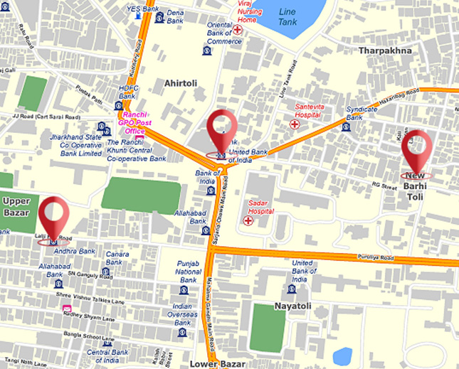
We supply vector digital map data of India that are GPS accurate and GIS ready. All data sets comply with accepted standards of spatial integrity. We source satellite images and special maps. We create 3D surface representations of buildings and topography.
Geodatabase Services

GEODATABASE SERVICES

We build customised spatial databases for several disparate industry domains. These data support terrain visualisation and demographic modelling, spatial planning, segmentation, gap analysis, site selection, navigation and more. We also collate special interest map databases like government assets and auctioned mines.
Custom Software Development

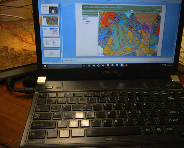
CUSTOM SOFTWARE DEVELOPMENT

We develop customized algorithms and APIs. We work on GIS OEM technology from ESRI and Open Source. Our experienced technical staff understand customer requirements and design software solutions keeping in mind users’ objectives. We emphasise security of data and ease of use.
Secure Hosting Services

SECURE HOSTING SERVICES

All data are secured and well protected. We host multi-year, pan-India Web maps from our proprietary geo-database, and also other user organisations' data overlays and graphics. We provide privileged Dashboard access to several online analytics and reports.
gis services